How to create XYZ orthophoto tiles with QGIS
![]()
Spatial Geographic Analysis (GIS) raw orthophoto files are usually tif or jpg based, but making xyz image tiles can improve display and loading speed. This article will show you how to convert an Orthophoto to an xyz tile using QGIS.
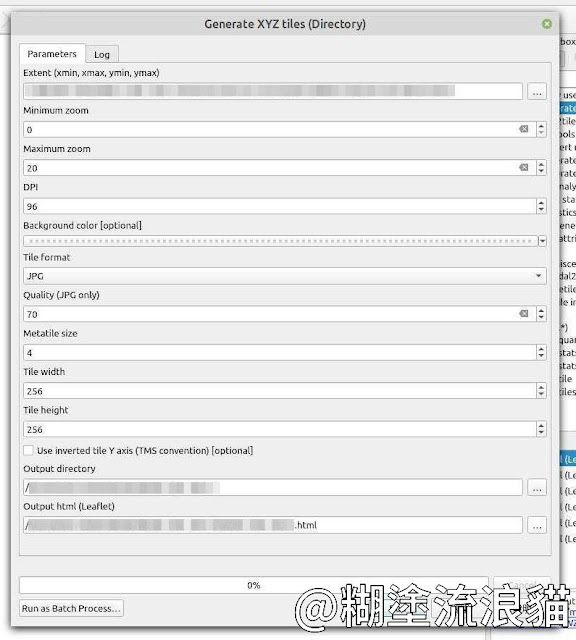
Generate XYZ tiles (Directory)
Processing Toolbox > Generate XYZ tiles (Directory)
Extent : Use Draw on Canvas Select the target on the map.
Minimum zoom : 0
Maximum zoom :20
Tile format : PNG, JPG
Close other layers before execution to avoid generating tiles along with the base image.
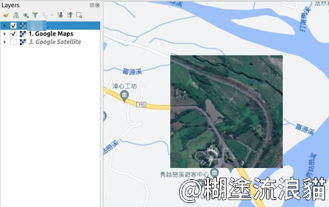
Add XYZ layer in QGIS
Browser > XYZ Tiles
New Connection
Max. Zoom Level: 20
URL:
file:////home/user/Orthophoto/map000/{z}/{x}/{y}.jpg
Result


留言